Wednesday, November 29, 2023

The Suwannee, So Dark It Reflects Beauty

One might imagine an intimate, slow, winding river, full of alligators coming out of a cypress swamp, yet the Suwanee River is a wide jet-black river with steep banks, occasioned by the wide sandy beach.  It is a river with a pace rather than a standing swamp.

We chose to canoe the Suwanee River because the amenities for canoe camping are known to be incredible.  The State of Florida provides screened platforms to sleep, picnic tables, fire circles, electricity, and bathrooms complete with hot water for showers.  And all of this is free or you can pay a minimal charge to reserve your spot along the river.  We wanted Ruth’s brother, David, and sister-in-law, Debbie, to have a great experience their first time on the river and so we tried to make canoe-camping as easy as possible – no roughing it for them – they would have the ultimate canoeing experience. 

Our plans for this ultimate experience would soon go awry, and we had a different kind of ultimate!  A few days before our trip, the local outfitter let us know that Suwannee River State Park was still closed due to hurricane Idalia.  Suwannee River State Park was to have been the end of our river trip.  Hurricane Idalia had passed through the upper peninsula of Florida in late August and we were canoeing in October.  We had assumed the area would have been completely recovered from any damage.  Surely, they could have gotten a park in working order.  What kind of repairs did they need to do?  Not only that, our outfitter told us that the Wilderness River Camp at Holton Creek, where we had hoped to stay, was also considered closed. We never received word of this from the Florida State Park online reservation service. The outfitter helped us decide that we could still do the trip, but instead of taking out at Suwannee River State Park, take out earlier at Gibson Park, making it a shorter third day.   So, here we go!

We planned an early start from the put in at Suwanee River Wayside Park, Hwy 41, outside White Springs, a sleepy little town.  We spent the night at the only hotel in the vicinity, Quality Inn, which was decent but on this Sunday there were no restaurants open and we had to go to Live Oak to get something to eat, which was a hub of activity with restaurants and motels.

The next morning, we unloaded the canoes and dry bags at Wayside Park as Hwy 41 crossed the Suwannee River and the drivers drove the cars to Gibson Park to meet our shuttle.  We had contracted with Suwanee River Canoe Rental (located near Suwannee River State Park) to drive us back to the put in.  Those of us who stayed at the put in waiting for their return, realized Wayside Park was a drive through and hang out place, even early in the morning. We must have not looked very interesting because several cars rolled in quick, took a look and rolled right on out.  Over an hour later, the shuttle had arrived with our missing drivers.  We loaded the canoes and were ready to paddle by 9:30am, an early start for us.

We were surprised at the speed of the river as we began our paddle.  The depth of the river was near its high-water mark, as we could not see any water line marks on the banks of the river.  This high water caused the river to be flowing faster.  We settled into an “Ahh! Experience” of loving the cypress greeting us in their beauty and stillness – a feature of Florida rivers.  The cypress trees along the river release tannins that cause the water to be black.  One doesn’t look into the water, with its being so dark, it becomes a mirror, reflecting back everything not in the water.  Also, striking to see were the several limestone outcroppings on the sides of the river which looked like giant bracket fungus, hanging over the sides of the river.


This part of the Suwannee River offers several side trips to get out to explore, the first coming soon after the bridge for Hwy 136.  It was The White Springs, encased in a building of cement/rock/coquina mixture in the early 1900’s.  It was Florida’s first tourist attraction, people coming from all over to experience healing from the spring’s sulfur waters.  The town grew to have 14 luxury hotels.  The spring is no longer spectacular to see, but the remains of the structure are still standing. 

White Springs, circa 1911


Bird's Eye View from the White Springs Pool

Leaving the springs area, the next stop is Stephen Foster State Park, a park that hosts the Florida Folk Festival every year.  We were looking for a convenience stop but did not find any.  We could see that they are renovating their boat ramp and it will be finished soon.  It will make a nice place to put in.  At the moment, the boat ramp was closed.

There were not many places along the river that were flat enough or dry enough to get out and stretch, or have a snack.  It might be because of the high water.  One of my favorite side trips was turning our canoe up Louisa Spring.  The entrance to the spring-fed creek is on the right side of the river, a short distance before the I-75 bridge.  Here a foot bridge of the Florida Trail crosses the tiny spring flow. The spring creek is barely wide enough for one canoe with the sharp, rocky limestone walls on both sides.  These sharp walls were perfect for the growth of ferns and we actually found begonias tucked into the nooks and crannies of the limestone.   As we paddled further back, the current became stronger and the black water actually started becoming clear with the fresh spring water feeding it.  It was a totally new world.  But our stomachs were talking to us, and no one had the energy to keep going to find the source; we turned around because we just wanted to eat lunch.   

Canoeing Up Louisa Spring, Florida Trail Bridge


Begonias on Rough Limestone Walls

Entrance to Suwannee from Louisa Spring Access


We stopped at Rocky Creek Rest Stop for lunch, and set ourselves up on the sandbar.  We shared the space with some local people who were fishing.  They were the first people we had seen all day.

When we got back on the river, we realized we only had 3 miles left to paddle.  David hadn’t been canoeing since he was a kid, but we sure couldn’t tell.  We had to paddle constantly to keep up with David and Debbie. We were at Woods Ferry Camp, our destination, in less than an hour.  The camp can’t be missed.  It is on top of a bluff on the left side of the river and has a long zig-zag ramp from the river to the top of the bank. 

Zig-Zag Ramp at Woods Ferry Camp


The camp is really set up to care for guests.  Canoe racks are at the river level to leave canoes in a safe space, not to be swept away by changes in water levels.  There are also carts for carrying all the gear up the zig-zap ramps to the camp.  Load them up!  

Carts to carry dry bags and luggage


Canoes being unloaded before put on the canoe racks.

A camp host greeted us at the top.  We had reserved Pavillion #1, handicapped accessible.  It was waiting for us, and offered a place to recharge electrically and physically. 

Pavilion #1 at Woods Ferry


View of the Suwanee from a Bluff, Love the Colors


BUT, the hurricane had messed up so that there were no hot showers available and even though there was water in the pipes, the host did not think we should trust it for drinking.  No problem, we just needed to boil the water.  The evening was restful until we hit the sack.  Interstate 75 could be heard all night and very late at night we heard three pops of a gun.  Debbie was planning on where to hide if they came for us!  We had purposedly planned this trip after October 15th, which was the end of gun season for that area, so I was surprised to hear the shots in the middle of the night too.

The next morning, we were again on the river by 9:30. We had an 18-mile day before us, so we made steady progress not making many stops.  There were many more sand bars on this part of the river so, it was easy to find places for stretching and lunch. 

Photo by Debbie Lantz


Many Sandbars to Stretch and Relax           Photo by Debbie Lantz


The perfect place for lunch was at Suwannee Springs.  It wasn’t well marked so we almost missed it.  David and Debbie went to check out this weird building – and find out it is enclosing a spring.  The frame of the “building” is made out of limestone with arch windows.  If you see this RIGHT on the river, you will know that you are at the spring.  


Limestone walls around Suwannee Springs


Wade in the spring, smell the sulfur, and 
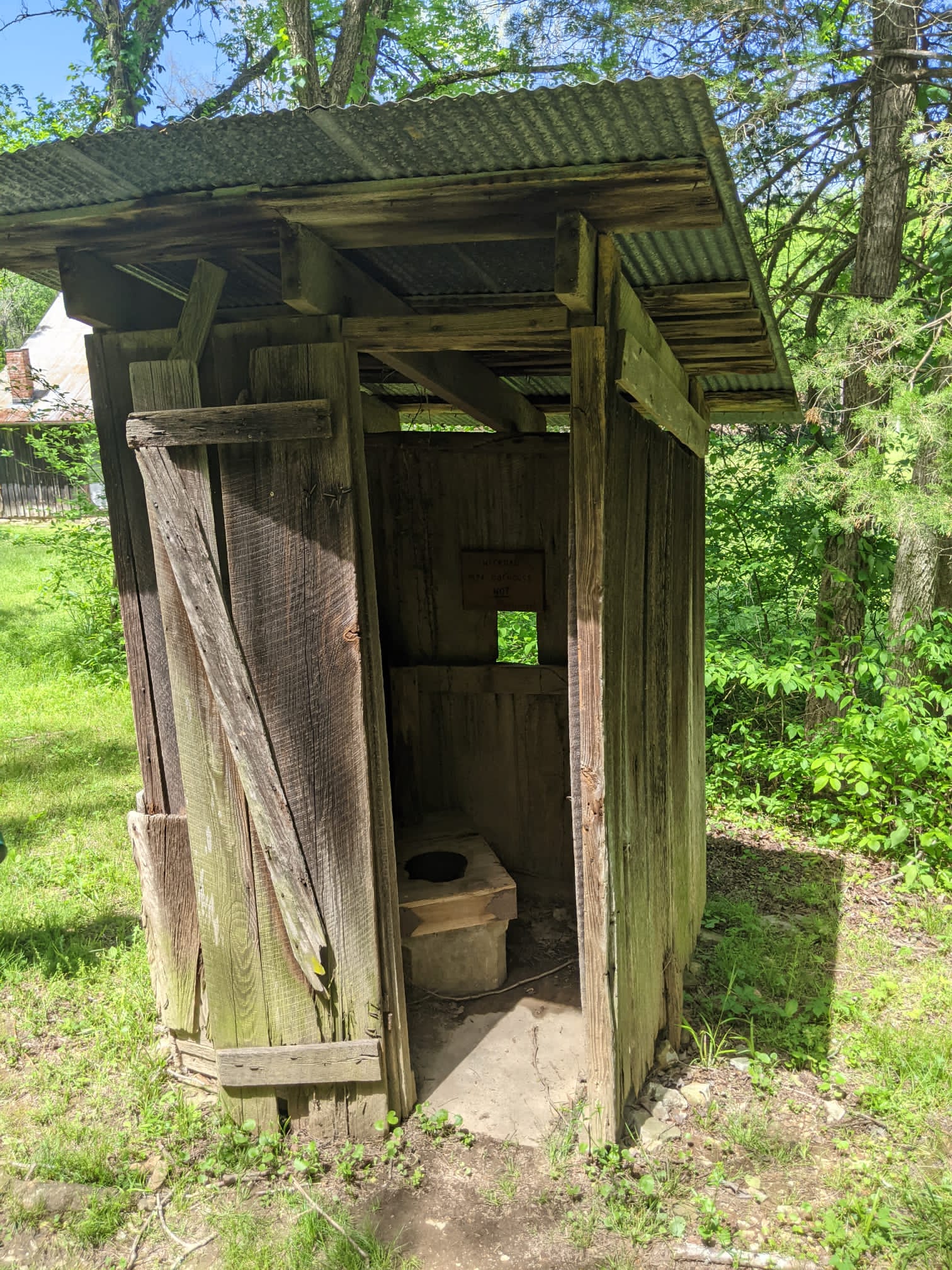
have a picnic on a table on the grassy manicured lawn.  There are also port-a-potties available.  As you leave this area, enjoy the art on the abandoned 129 bridge.


On the left of the river is the Spirit of the Suwannee River Music Park. We were told by phone that there were no accommodations at the park, but we believe it is because the hurricane tore the place up so they were actually closed.  We could see one of their treehouses from the river.  As we passed Deese Howard ramp on the left side of the river, we remarked at the quality of the boat ramp – it’s width and openness. It is found at the end of 103rd Road.  That would be a good put in site.

We are really making good time, not playing around, but doing solid paddling. On the left side of the river there is an indication of the Florida Sheriff’s Boys’ Ranch between mile marker 143 and 142 on the map.  A boat launch was being built and it looked quite sturdy.

It wasn’t long before we found Holton Creek River Camp.  We pulled our canoes onto the dock and walked up the wooden steps. No host greeted us here, but it was devastation which greeted us.  Massive trees felled all over the camp by Hurricane Idalia.  The toilets and showers were demolished as well as one screened sleeping platform.  

Demolished Pavilion at Holton Creek

There was no access to water or electricity.  This was no longer the ultimate in canoe camping. This was the “roughing it” that we were trying to avoid. Yet we had still received confirmation of our camping reservation by email and then afterwards a survey to ask how our camping experience had been!  It was only in the middle of November when we received an email letter giving notice that Holton Creek River Camp was closed as of September 5 and up until April 2024!  A full month after we camped there.

After surveying the entire camp, we found screened platforms that we felt were safe (with no hanging trees precariously dangling above) and made camp.  We had brought along enough drinking water and used the river water for washing dishes.  It was a quiet evening as we were further away from civilization.

As we pondered our time on the river that evening, we realized that the wildlife that we would have expected on a Florida river were not here.  We did not find any wading birds or ducks, birds that we associate with the water. There were a few kingfishers and pileated woodpeckers and a few warblers traveling through, but that was it.  Few turtles, no alligators.  We did observe a young deer trying to cross the river, and another deer early in the morning which were lovely sightings, but we found it sparse.

Early Morning Mists on the River


We woke early each morning to witness the mists coming off the river including our last morning. We were again on the river by 9:30 with remnants of mist around us. We only needed to paddle 5 ½ miles – a 2 hour trip.  Our only side trip this short day was going up the Alapaha Rise, trying to understand how a river first flows into the ground, and then further on, flows up out of the ground.  It was our first experience with this terminology or seeing this geologic feature.  The Alapaha Rise is only a short distance from Gibson Park and the main part of the Alapaha River itself.  Gibson Park ramp is set off from the main part of the river.  Alas, most of the park was closed including the restrooms and access to water, due to the hurricane.  Loggers were busily working on clearing the debris from the park. This 3 day trip was invigorating for all of us.  David and Debbie were making plans to explore other parts of the river – as we also thought the Suwannee would be a great place to take the grandkids!  This jet-black river was beaconing all of us to explore deeper.

Resources:


https://www.naturalnorthflorida.com/blog/wp-content/uploads/2015/09/SRWT_Guide2015_Ver2a.pdf
This is the Suwannee River Wilderness Trail Paddling Guide which is absolutely necessary. 

https://www.suwanneerivercanoerental.com/
This is the shuttle company we used.

Thursday, July 15, 2021

Canoeing on Grayson Lake? Really? Yes, Fall in Love with Clifty Creek!


Canoeing on Grayson Lake?  Really?

Yes, Fall in Love with Clifty Creek!


            The love of canoeing will take you to places of awe, which are inaccessible by foot.  Hidden, mesmerizing, and true treasures.  Our magical destination on Clifty Creek was Hidden Cove Falls which is also called Grotto Falls.


Grotto Falls or Hidden Cove Falls

            To get to the Clifty Creek Boat Launch, we headed south on Hwy 7 from Grayson.  We went past Grayson Lake Dam and then a little less than 2 miles turned right onto a gravel road before the Clifty Creek Bridge.  Access to the water is easy, and we headed up the creek.  Going early in the day and avoiding the weekend allowed us to “have” the falls all to ourselves, without jockeying for position within a tight space.  The destination might be Hidden Cove Falls, but Clifty Creek is beautiful on its own.


Along Clifty Creek, we were inspired by the towering sandstone cliffs, rhododendron and hemlock gracing the cliffs on our short 1 ½ mile float.  

Towering Sandstone Cliffs


It had rained during the night so there were several seasonal waterfalls, falling off the cliffs into the creek.  Being a hot summer day, we availed ourselves of a shocking shower.  The grandchildren found it hilarious and wanted to shower over and over.  So that each showering water falling from the cliffs was an enticement to get wet and enjoy the screams of refreshment.

Enjoying the Season Waterfalls

 There is a rock island on the way, with a hemlock growing off the top which was so picturesque.  We canoed around it several times.


Rock Island

We could not find Hidden Cove Falls on any map of Grayson Lake.  It is hard to describe it's location. And some people miss finding it entirely.  So pay close attention. Somewhere between a 1 - 1 1/2 miles as we were paddling along, we saw what appears, at first glance, to be a short bay off the side of the main waterway.  As we looked, it appeared to become shallow, ending in a bunch of weeds.  But looking higher up we saw that the land doesn’t close in behind this.  The land appeared to continue to be open as if the lake keeps on going.  As we approached we found a turn in the water behind some trees and rocks.  The water winds back around to go in between some massive rocks that look as though they were once a single rock that split in two. The narrow waterway is like a slot canyon and we could touch the massive rocks on either side of the water path.  Our canoes barely made it through, so kayaks would probably work better.  The water path continued between the rocks for another 50 feet and then opened out into a pool with a beautiful cascading falls at the far side.

Narrow waterway to get to Hidden Falls


Our Canoe Barely Fits


Seeing, feeling and hearing the thundering power of water in a calm pool amidst the surrounding giant boulders gives a sense of peaceful wonder.   As we float there feeling the falls cascading and soaking in the beautiful setting, we find that we don’t want to begin our journey back to camp.  Just a little while longer…. Just a moment more.  To hold this feeling, to remember the sense of wonder, is why we canoe!


Photo by Debbie Braaksma


Notes:

  • ·       Go in the morning or in the middle of the week to enjoy Hidden Falls without crowds.
  • ·       Take a trash bag.  Clifty Creek boat launch is trashy and so are the banks along the creek.  The creek itself seemed clean.  Help make it a better experience for those who canoe after you.
  • ·       Make the trip after a day of rain to experience the seasonal rainfalls off the cliffs.  Wear a bathing suit to dry quickly after canoeing through the waterfalls.
  • ·       Make reservations to camp at Grayson Lake State Park to be able to get an early start.

Sunday, June 6, 2021

Braving the Buffalo River


Braving the Buffalo River


            I floated down the Buffalo over ten years ago with my teenage daughter.  I loved it and wanted to introduce my wife and friends to it.  But a lot can change in ten years.  We should have gotten a clue when we were checking in with our shuttle, and heard them explaining to a group that the Upper Buffalo is only for experienced paddlers.  We thought we were experienced paddlers.


             A beautiful day in May, we, along with many other canoers, started at Ponca by driving across the low water bridge to load and launch the canoes. We chose this spot as we would have an easier access to the section of the river which immediately goes under Hwy 74 bridge.  Once our canoes were launched, we quickly realized the strong current of this river would make it difficult to steer, so that, by the second set of rapids we found ourselves being swept around a curve straight into an upended tree.  Our friends seeing our predicament, paddled into the shallows, only to be swept sideways. 

Launching at Ponca


            The river was deep, the current was strong and the rapids non-stop.  We felt as if the river and fallen trees were colluding to cause us problems.  Early in the day, the strong current worked to push the canoe into an overhanging tree as we tried to maneuver the bend.  As the current pushed the canoe closer to the overhanging tree, we struggled with immense paddling and prowess, only to lose; and found ourselves pushed from the canoe into the water. We soon saw a pattern.  We would be pushed by the river into a fallen branch, and then shoved by the branch into the river.  We were glad that we had worn our quick dry clothing and that the sun was shining!  It was also at this point that I decided that I was actually going to wear my life preserver.  Our advice would be: be prepared to get wet – not only from trees shoving you out of the boat, but from two-foot waves splashing over the boat caused by underwater boulders.  Also, make sure you bring something to bail out the canoe.


            Having barely gotten started on our trip we found it to be a tension filled river with the technical rapids of quick bends and downed trees, so we were relieved to take a break for a hike to the Hemmed-in-Hollow Falls.  Surprisingly, a man on horseback appeared on the shore and pointed us to the falls takeout. From the river, it is approximately a mile walk along a bubbling creek of small falls and ledges.  Hemmed-in-Hollow Falls is a 209 ft fall, the tallest in the state and some say the tallest between the Appalachians and the Rockies.  It had a calming effect, wiping away our tensions from the fast paced river.


The Trail


The Brook


Hemmed-in-Hollow Falls


Back on the river, our anxieties soothed, we were able to start enjoying the towering cliffs of gold, black and white, the trickling of water falling off the ledges and the milky lichen green river.  Even so, we still had to stay alert at every minute.  It was rare to be able to have time for a drink of water or to take a posed photo.  We were pleased to find that we hadn’t seen the first evidence of trash in the river.

         The Gold, Black and White Towering Cliffs (Credit: Debbie Braaksma)


            Our first night, we camped at Kyle’s Landing, a well maintained campsite.  A cost of $20, it had real toilets, water, picnic tables, and a fire ring with wooded sites that are widely spaced from your nearest neighbor. A nice service on the Buffalo River is that each campground has a free emergency phone located at the restrooms.


            As we talked over the day, we rationalized that our difficulty in controlling the canoe was because we were very loaded with gear.  So, the next day we emptied our water containers which reduced our load by 50 pounds.  But we found that wasn’t the answer.  We had not gone far the second day when the fast current and branch partnership colluded to knock me out of the canoe.  I couldn’t get my footing and kept trying to reach the canoe coming up to try to grab the canoe and get a breath of air.  As the canoe came into this obstacle, the bow paddler had ducked and missed the branches, but was now trying to control the canoe in a fast current level 1+ rapids from the bow.  She finally got the canoe to calmer, shallow water, and the rocky shore.  As I got my footing, we turned around to see our friends canoe completely upside down, going sideways down the river.  When we righted it, every piece of camping equipment remained in the canoe.  That sure was some good rigging and tying down.  One of the rules for the Buffalo is that everything must be tied down, and now we could definitely see the advantages!  It did take us awhile to bail out the water, to just sit on the shore in the sun to get warmed up and recover from the adrenaline rush.  We compared all our bruises and scrapes while taking time to pep each other up.  I lost a hearing aid and our friend lost his glasses, unfortunate losses but there was no backing up for a “do over”.


            Everyone we talked to on the river had some story of tipping over, many with the same words, “We have never tipped before; until today!”  And others with the words, “The Buffalo is some SPECIAL river!”  After this third time of being edged out of our canoe, we decided on a new way to tackle the rapids – just walk through the shallow areas and pull the canoe through, going around the more difficult parts.


Credit by Debbie Braaksma

Credit by Debbie Braaksma

Photo Credit by Debbie Braaksma


             We ate lunch across from a beautiful craggy bluff between mile marker 112 and 111.  When we were almost to Erbe, there is a standing wave across the entire river. We should have paid closer attention, because this is a drive through concrete road that crosses the Buffalo River.  If we had known, we would have gotten out on the left side and explored the Jones farmstead and the remains of the Erbe town.  On the map it appears to be a bridge crossing the river.


            This, our second day, had been a whopper of a day, so we were glad to have only traveled 6 miles. We camped at a group campsite at Erbe.  It was a long trek to carry all the camping gear.   These campsites are not as maintained as Kyle’s Landing. Several of the vaulted toilets were closed. In fact, there is no running water even though the current National Geographic map led us to think there was.  Remember we threw out all our drinking water to make our canoe lighter?  That wasn’t very wise and we weren’t mentally prepared.  So, what we figured out is that we need to use the National Park maps for up- to-date information about the conveniences at each campsite, but use the National Geographic topographic map for more details on the river.  We spent two nights at the campsite, reading, fishing for small mouth bass, hiking and exploring the local historic Parker-Hickman farmhouse. 


            The ½ mile hike to the Parker-Hickman farmhouse is along a dirt rocky road from the campsite.  The house was built in the 1840’s, added on to, and lived in until 1978.   The house and farm buildings are all intact and are open so you can visit inside.  The walls were plastered with newspapers and the ceiling with wallpaper samples.  There was no indoor plumbing so one interesting addition was an outhouse built by the WPA in the 1930's.  We continued past the farmhouse down to the river and realized we were on the road that became a concrete slab, which we had seen while in our canoes,  to cross the river.  During this last part of the dirt road, the road is mostly pebbles making it harder to walk.  This becomes a good place to talk about the bottom of the river, a constant supply of large pebbles.  Minimalist water shoes were not the best choice for walking this river.

Parker-Hickman Cabin


The WPA Outhouse


            Our third day on the river was from Erbe to a gravel bar past Pruitt.  The river was less intense and even though we still got out and walked a few rapids, it was less technical.  This allowed us to relax a bit and enjoy the scenery.  It seemed as if the bird life became more abundant, but in reality, it was probably because we didn’t have to focus on the rapids as intensely.  We saw little green herons, great blue herons, pileated woodpeckers, indigo buntings, pipits, and many warblers.   


We stopped at Ozark campsite for water.  It is not well marked, but we could see some cars through the trees.   As we were collecting water, the sky darkened and the wind was whipping up.  It was going to rain. It was great timing for lunch.  We beelined for the large covered picnic pavilion and had the opportunity to wait out the storm.  It would have been a nice place to camp, with flush toilets, water, and campsites near the water, but we still had quite a bit more river to cover.


            We had remarked on the pristine quality of the Buffalo River and its lack of trash.  Yet after Pruitt, we started seeing tires in the river.  It was as if people stood on the bridge of Hwy 7 and pushed them over into the river.  Since we left Ponca, we had not gone under a bridge until Pruitt. The other boaters had also all disappeared.


            Our last night camping on the river we found a secluded gravel bar on the Little Buffalo, where it joins with the Buffalo River.  The gravel campsite gave us a view of both rivers and bluffs across the river.  It was perfect for the evening.  A lone Canada goose flew mournfully in, circling and honking.  It’s partner soon joined it.  We had company.

Campsite on the Little Buffalo Confluence


            The last day on the river was from the confluence of the Little Buffalo to Carver, a trip of 7 miles.  It was uneventful and quick.  As we got out at Carver, fishers were launching their boats and Park Rangers were in their vehicles on the shore.  We were allowed to load up our vehicle on the rocky shore and the responsibility of the rangers was evidenced by their waiting to make sure we didn’t get stuck in the sand or the steep ascent off the beach.


At the end of our four days on the water, we took notice of a sign that we should have read as we embarked on our trip.  “River is High and Dangerous.  Experienced Floaters Only.”


NEED TO KNOW:

 ·       Wear life preservers.

·       Wear eyeglass straps.

·       Strap Everything down and include a locked cooler.

·       Make sure you have dry bags or that your dry bags work.

·       Be certain that you bring along only essential items.

·       Be prepared to get wet and make sure you are wearing quick-dry clothes.

·       Don’t trust the maps for conveniences.  Talk to rangers ahead of time.

·       Be ready to bail water.


NEARBY ATTRACTIONS:

·       Arkansas honey

·       The town of Mountain View for local  mountain music

·       Serenity Farm Bread, a bakery in Leslie

Thursday, November 19, 2020


Paddling the Patoka during a Pandemic


So what do you do during a pandemic? Go Canoeing!

Maybe not an answer that you would come up with, but that is exactly what we did. So, where do you go? Especially when one of the canoes is a handmade wooden one. Rivers in Kentucky get very low in the winter and are full of rocks, not so great for a wooden canoe. So Lake Patoka became our destination. It is known for fishing and speedboating.

We spent one beautiful sunny Friday in November out on this lake. It is 45 minutes from Louisville, so an easy drive. Take I-64 west and get off at the exit heading for French Lick. Print off a map of Lake Patoka before you leave and locate Osbourn Ramp on it. (The maps I found did not have the ramps delineated on the map; roads just ended in the lake!) After you cross the bridge over a section of Lake Patoka on SR 145, turn right off of SR 145 towards French Lick Cabins. Osbourn Ramp is at the end of the road. Each Patoka Lake entrance ramp has concrete ramps, ample parking with public restroom facilities. We did not find water at our entrance site, however. We chose Osbourn ramp because it leads to the more narrow channels (fingers) of the very large lake, the second largest reservoir in Indiana. To paddle to these narrower channels, canoe to the left (and not the right) after disembarking from the ramp. We were fearful of being on an open lake and having to paddle against the wind to get anywhere, but this part of the lake was narrow with many fingers. We set off, 3 canoes with 6 people paddling, and quickly began to enjoy being out on water in a canoe again, oh, and one dog. The water was calm, the sun was warm, there were very few boats in sight and the fall colors were still present with oranges and yellows. Can you think of a better way to spend a sunny November day?

Look at that Amazing Day on the Lake!

As we paddled we saw on the left, off of one of the fingers, what looked like a cave in the cove of the lake. We paddled closer to inspect and found a large overhang on this cove, with some water dripping off of it into the lake. We explored this interesting site and then continued on our way.

Large Overhang at the End of a Finger of Lake Patoka

Canoe in and Canoe out of this Cove

We got a late morning start on our trip and so we began looking for a piece of flat lakeside to stop and eat our lunch, masked up and social distancing, of course. We saw a site that looked fairly flat and large enough to accommodate us; so we headed there. The closer we got the steeper the bank looked. Nothing else looked better so we decided to go for it. After setting up our portable table and finding rocks to help level out our chairs, we enjoyed our time with our lunch catching up with friends. After lunch, we paddled around the nearby bend in the lake and found a very nice flat area that would have been perfect to stop on for lunch. Oh well.

The Beautiful Shore

We Love the Layers in the Rocks.

Lake Patoka became a reservoir in the 1970's. So we were canoeing through submerged forests. The tops of the trees were peaking out above the water, or hiding below the surface. The paddler in the bow had to be on the look out for these hidden trees. The dead trees that have been below the surface of the water for almost 50 years are still strong! They are strong enough to grab a canoe and not let go! Our friends canoed on top of just one little point of a tree, and couldn't get off! It seems silly to think that these tree tops could have that much power! At the same time, these submerged forests limit the speedboats in the area, and make it a perfect place to canoe.

The Submerged Forest  Photo by KT Ockels

We realized that we needed to pay attention to where we were going so we could find our way back to our vehicles. The lake has many side fingers that, we found out, are actually just a continuation of the lake into other valleys. If you don't pay attention you could find yourself spending a lot of time going into the wrong sections of the lake. Fortunately, we kept track and found that we were good navigators!

Pandemic fatigue? Get out into that sun, on a quiet lake and canoe! Use your navigational skills, paddle and enjoy! You can even socially distance with friends. Maybe even on Lake Patoka, an easy float, with pretty scenery making a pleasant outing.